Where is Sinjajevina?
.
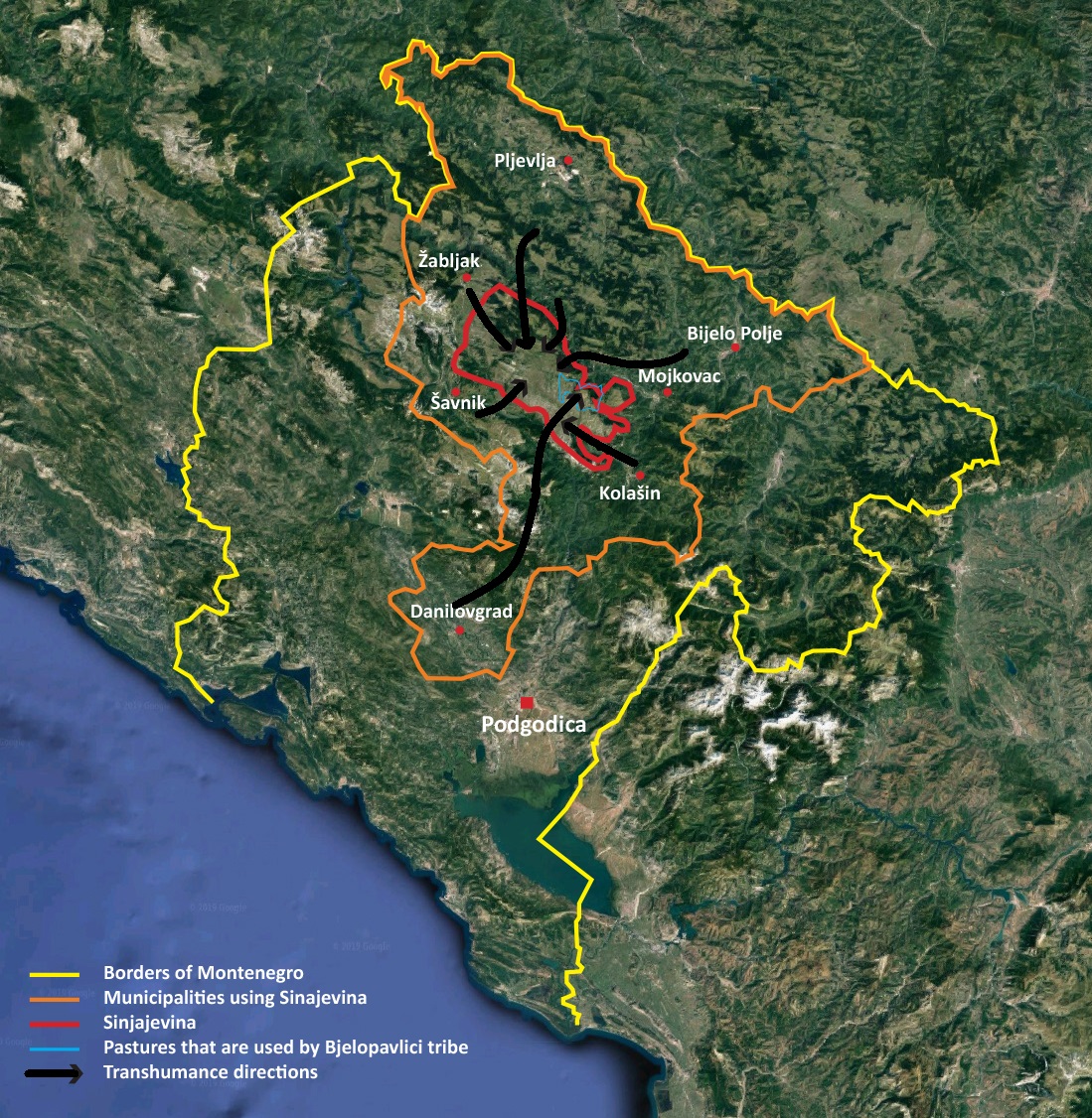
Sinjajevinais a mountain system in northern Montenegro. The highest point of Sinjajevina is Torna peak, which is 2,277 meters high.
The Sinjajevina massif stretches from SE to NW, between town of Kolašin and village of Njegovuđa, near Žabljak. It is 40 km long and 15 km wide. [Source: Wikipedia Commons]
*Sinjajevina Location in Montenegro
Sinjajevina-Durmitor mountain range
The Sinjajevina-Durmitor mountain range is the second largest mountainous grazing land in Europe: an over 1.000 km2 limestone highland between 1,600 and 2,500 meters above sea level, with a unique biodiversity that has coevolved with pastoralism through millennia. It hosts some of the most outstanding alpine landscapes in Europe.
The uniqueness of the biodiversity hotspot within Montenegro has been recognized through the establishment of numerous Natural and Cultural protected areas.
The highland pastoral settlements, or “katuns”, scattered over the territory of Sinjajevina belong to eight major tribal groups.
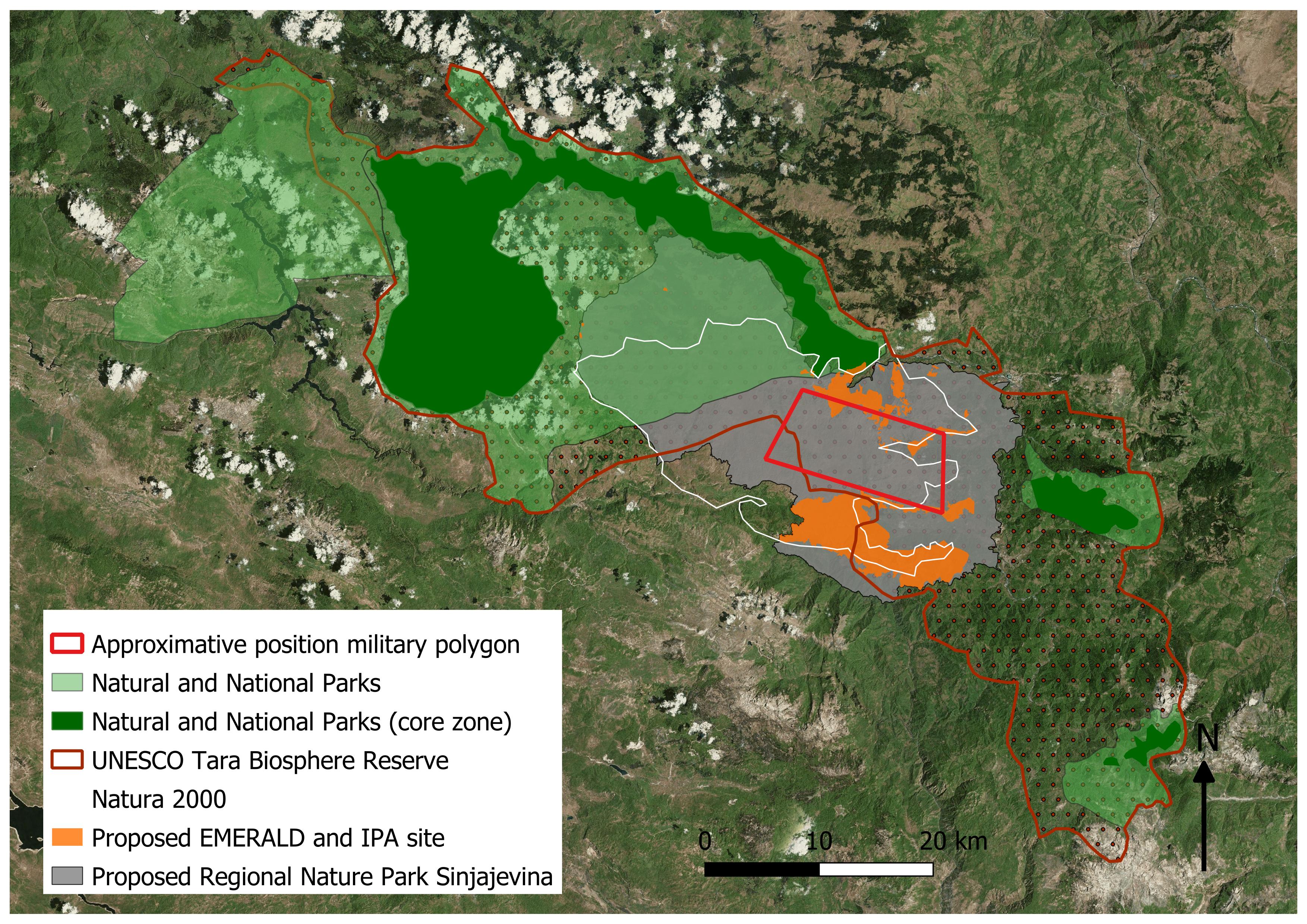
Today, a project to install a military training and weapon testing polygon on a large portion of Sinjajevina’s territory now critically threatens its distinctive natural and cultural landscapes and the livelihoods of thousands of people.
Files section
- Article has no files.